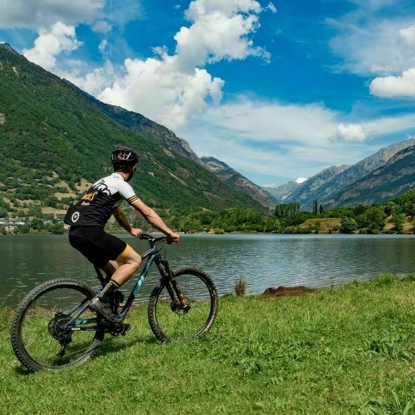
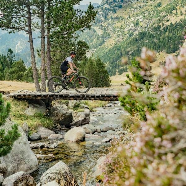
Tracks del Aneto is an impressive high mountain route in the heart of the Aragonese Pyrenees. You will pedal under the watchful eye of the Aneto (3,404 meters), the highest peak in the Pyrenees, while enjoying the wonders of nature in the Posets-Maladeta Natural Park.
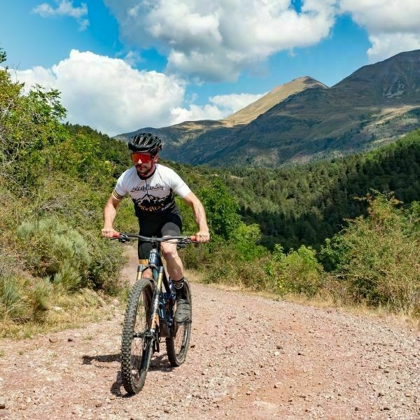
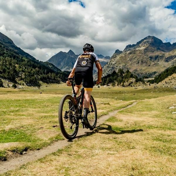
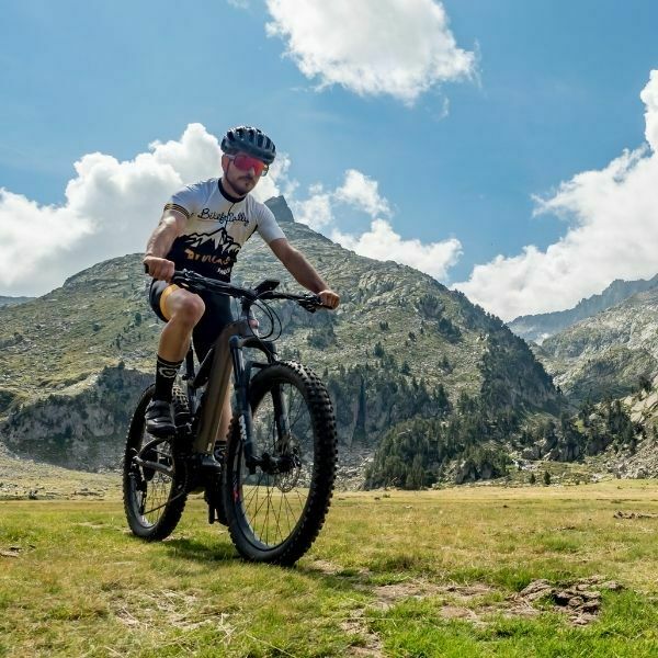
In Tracks del Aneto you will cross the high part of the Ribagorza region located in the heart of the Aragonese Pyrenees, where the Posets – Maladeta Natural Park is located, crowned by the Aneto peak (3,404 meters). You will ride through the most authentic and unspoiled corners of the Pyrenees, enjoying the valleys of Benasque, Isabena and Castanesa. Sighting a bearded vulture or a capercaillie can make it one of the most unforgettable routes you have ever done. The Puro Pirineo MTB center offers a variety of trails where the most daring will enjoy the most. The 2-day route is the most endurera of all but the 3 and 4 stage versions are undoubtedly the most spectacular, with passes at more than 2,300m of altitude.
Get deep into the Benasque Valley with this mountain bike trip in stages. Ready for a great adventure on wheels?
THE TOP OF THIS ROUTE
Rest in Bikefriendly accommodations
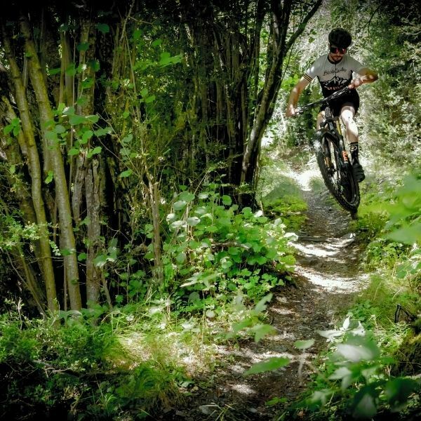
Enjoy the trails and descents of the Puro Pirineo MTB Center.
Marvel at the spectacular views of Aneto
Taste the typical gastronomy of the Pyrenees
Visit the spectacular Estós Valley and its high mountain refuge.
Ideal bike: Double suspension bikes are recommended for this route.
Tires: Versatile tires are the most appropriate, as you will find different surfaces: rocks, dirt tracks, loose stones, cobblestones, etc. It is best to use tubeless or inner tubes with liquid sealant.
Orientation: You are doing a mountain route and the weather changes rapidly, it is advisable to carry a windbreaker as a minimum. We recommend carrying a backpack with water, a multi-tool, and enough spare parts such as cameras, even a thermal blanket and a small first aid kit are never superfluous.
Best season: Spring and autumn are the most pleasant seasons, since summer is usually hotter. It is closed in winter due to snow.
Type of roads: Followed with Gps equipment, either with your own or we can rent you one. We deliver the track in GPX format. The organization also provides the participants with a map of the route with points of interest during the stages, restaurants, lodgings, etc.
Philosophy: This is a route that seeks to cover tracks and trails with little traffic and therefore technical, both uphill and downhill. Depending on your technique and strength, the route is 95% cyclable. There are some uphill and downhill sections that are only within the reach of bikers like Ismael Ventura, Milton Ramos, or Sergio Perez. It is quite a challenge to reach Aigualluts and have before us the mythical Aneto.
Luggage transport: Considering the technical nature of the route and altimetry, it is advisable to hire this service.
Mechanical assistance: The organization offers the service of support on route, in the briefing we explain the rates.
Provisioning: In the initial briefing we will explain it to you on the route map, but we advise you to carry a backpack with enough water and food to ride all day, since there are some stages that do not pass through inhabited towns.
Use our online calculator and get an instant quote for your dates. Leave us your contact information so we can help you if you have any problem during the process of searching, calculating or booking your trip.
WOULD YOU PREFER US TO HELP YOU?
REQUEST A QUOTE
We will contact you within 48 hours to send you a proposal for a tailor-made quotation for your trip.
MEET THE CREATOR OF THIS ROUTE
Christophe Gastan
I am like cheese: made in France and cured in Spain.
I will welcome you on the Tracks de Aneto route so you can discover by mountain bike the best corners of the Aragonese Pyrenees.
DON’T MISS A THING
SUBSCRIBE TO THE BIKEFRIENDLY CLUB NEWSLETTER
WHY IS IT WORTH JOINING THE BIKEFRIENDLY CLUB?
Special offers on Tracks Bikefriendly trips.
Offers and raffles for stays in Bikefriendly network accommodations.
Contests and giveaways.
Personalization of your trip at no cost.
Fill in the form and take advantage of all its benefits: discounts, offers, gifts ….
I am like cheese: made in France and cured in Spain.
I will welcome you on the Tracks de Aneto route so you can discover by mountain bike the best corners of the Aragonese Pyrenees.
Gestionar el consentimiento de las cookies
Para ofrecer las mejores experiencias, utilizamos tecnologías como las cookies para almacenar y/o acceder a la información del dispositivo. El consentimiento de estas tecnologías nos permitirá procesar datos como el comportamiento de navegación o las identificaciones únicas en este sitio. No consentir o retirar el consentimiento, puede afectar negativamente a ciertas características y funciones.
Funcional
Always active
El almacenamiento o acceso técnico es estrictamente necesario para el propósito legítimo de permitir el uso de un servicio específico explícitamente solicitado por el abonado o usuario, o con el único propósito de llevar a cabo la transmisión de una comunicación a través de una red de comunicaciones electrónicas.
Preferencias
El almacenamiento o acceso técnico es necesario para la finalidad legítima de almacenar preferencias no solicitadas por el abonado o usuario.
Estadísticas
El almacenamiento o acceso técnico que es utilizado exclusivamente con fines estadísticos.El almacenamiento o acceso técnico que se utiliza exclusivamente con fines estadísticos anónimos. Sin un requerimiento, el cumplimiento voluntario por parte de tu Proveedor de servicios de Internet, o los registros adicionales de un tercero, la información almacenada o recuperada sólo para este propósito no se puede utilizar para identificarte.
Marketing
El almacenamiento o acceso técnico es necesario para crear perfiles de usuario para enviar publicidad, o para rastrear al usuario en una web o en varias web con fines de marketing similares.